 When there is no map for the 1,670 kilometres of Managua’s metropolitan
public bus network with its 45 lines, there is only one thing you can
do: ask the people on the buses how to get from one point to another.
When there is no map for the 1,670 kilometres of Managua’s metropolitan
public bus network with its 45 lines, there is only one thing you can
do: ask the people on the buses how to get from one point to another.
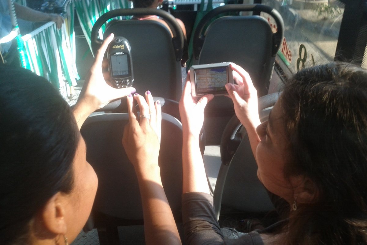
Once, a bus driver told us he had no idea about the route on his first day at work. His supervisors didn’t explain anything, so he made the most logical decision: he turned around and started asking the passengers where to go. And that is how he learned his own bus route.
The passengers of this complex, organically grown network within the capital know it best. Yet until recently, no comprehensive map of Managua and Ciudad Sandino had ever existed. Together, both municipalities see approximately one million boardings every day. And in seventeen years of existence, the city’s regulatory entity for municipal transport (IRTRAMMA), nor any private company, ever managed to produce such a transit map.
Two years ago, however, a group of Managua residents took the initiative and set out to create the first bus network map in all of Central America. All creators are regular users of public transportation, relying on it to reach their jobs, schools, universities and friends and family. Together we learned and mapped the public transportation network of Managua, drawing on new technologies and Free and Open Software — in particular the OpenStreetMap project and its ecosystem. More than 150 citizens collaborated in this enormous task to map all routes and bus stops across both cities.
The result of these efforts is available online. This map could only be made with everyone’s help, so it follows naturally that its data belongs to the general public. The information can be downloaded in different file formats, so that anyone can build upon it, improve it, create new products and offer new solutions for people.
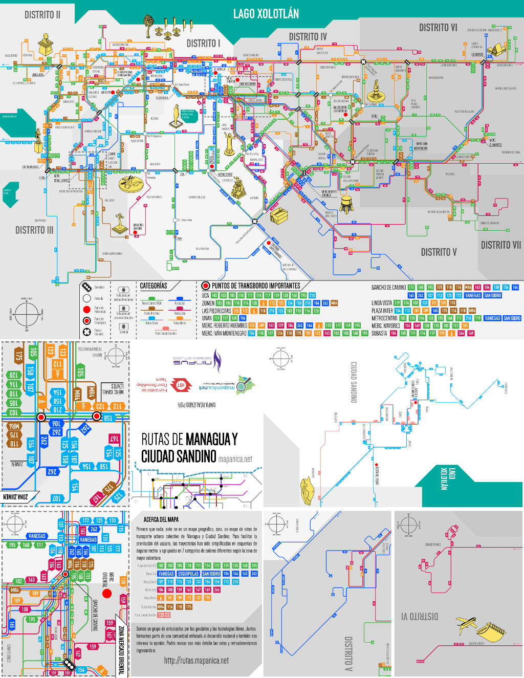
During this time we found more experts on the buses: the innovative designers from the Ninfus Design Studio. They are specialists in their field and regular users of public transportation, making them the perfect partners to design an optimised map that takes into account all the small details and local particularities people use to navigate the capital. The map was handed over at 9am at one of the main central bus stops (UCA).
We, the inhabitants of Managua, want to give this gift to the city and everyone living or visiting Nicaragua’s capital. This is just one example of how free (geo-)technologies in the hands of people, combined with their knowledge and effort, can move things forward. Everyone can make a difference by using the tools and resources available. Share your creations and make the world a better place!
Presentation of the initiative at the State of the Map 2016 in Belgium:
- Eighth article in my column "Brave new digital world" (Un mundo digital feliz) in the newspaper Confidencial.com.ni, where it has been published in Spanish language.
- Special thanks to Cinthia Membreño